


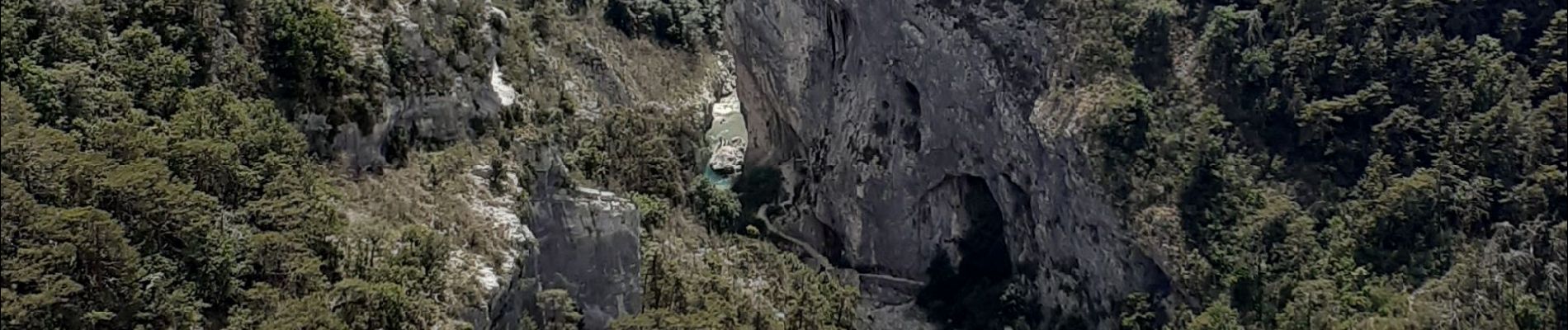
les malines au point sublime

RoMo
User
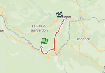

Length
15.7 km

Max alt
962 m

Uphill gradient
1337 m
Km-Effort
34 km

Min alt
562 m

Downhill gradient
1464 m
Boucle
No
Creation date :
2024-06-14 07:11:01.22
Updated on :
2024-06-14 15:55:08.808
4h23
Difficulty : Difficult

FREE GPS app for hiking
 SityTrail
IGN / Geographical institutes
SityTrail Plus
The world is yours!
About
Trail Walking of 15.7 km to be discovered at Provence-Alpes-Côte d'Azur, Alpes-de-Haute-Provence, La Palud-sur-Verdon. This trail is proposed by RoMo.
Description
beau circuit pour bons randonneurs
Photos


Positioning
Country:
France
Region :
Provence-Alpes-Côte d'Azur
Department/Province :
Alpes-de-Haute-Provence
Municipality :
La Palud-sur-Verdon
Location:
Unknown
Start:(Dec)
Start:(UTM)
286270 ; 4847152 (32T) N.
Comments